
As we have been sharing throughout the spring, water supply and river flows are already low across the Spokane River basin. Current conditions look similar to this time last year, before we saw a section of the river dry up completely. Many people have asked whether we are headed for another dry river this summer.
The answer is that we do not know, but it is possible.
Looking at current conditions, comparing them to last year, and comparing them to other recent low water years can help us understand what is happening in the watershed. But no single measurement can tell us whether the river will dry up. In fact, we still do not fully understand why the river lost surface flow last summer, which makes predicting when and if it will happen again very difficult. For comparison, we also looked at conditions in 2021 and 2015, two other years with very low flows when the river stayed connected all summer. All of the data below come from the USDA National Water and Climate Center and the USGS.
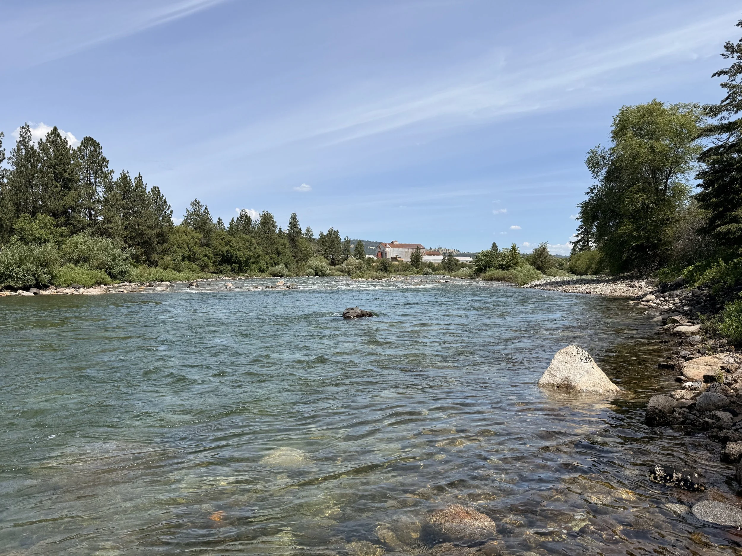
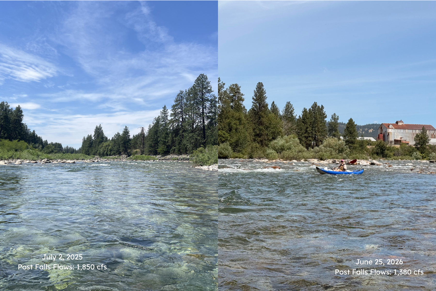
One of the easiest things to look at is river flow. Thanks to the recent rain, the Spokane River got a much needed boost. On June 30, flows at the Blackwell gauge, located above Post Falls Dam, peaked at about 3,200 cubic feet per second (cfs). For perspective, one cubic foot per second is about 7.5 gallons of water flowing past a point every second. Downstream, flows below Post Falls Dam reached 2,590 cfs, almost exactly matching the long term median of 2,600 cfs for this time of year. Even further downstream at the Spokane gauge in Peaceful Valley, flows rose to 2,900 cfs, 700 cfs shy of the 3,680 cfs median.

Those flows are driven by how much water is available across the entire watershed. One of the biggest contributors is mountain snowpack. Scientists measure this using snow water equivalent, which estimates how much water is stored in the snow and will eventually melt into streams and rivers. This year, snow monitoring stations reached zero snow water equivalent on June 25, just one day later than last year and only a few days earlier than the 30 year median of June 28. In other words, the mountain snow has now melted, and that seasonal source of water is already making its way downstream.
Not all of that snowmelt reaches the river right away. Some is stored in Lake Coeur d'Alene and the reservoir behind Post Falls Dam, where it can help support river flows later in the summer. Thanks to the recent rain, reservoir storage climbed to 103% of the median for the end of June, almost identical to last year and very close to the long term average.
One place where this year looks quite different is soil moisture. Soil moisture tells us how much water is stored in the ground. When soils are dry, more rain and snowmelt soak into the ground before reaching streams. When soils are already wet, more water is able to run off into rivers and creeks. At a depth of 20 inches, soil moisture is currently 106% of the median, compared to just 46% at this time last year.
At first glance, that seems like really good news for the dry river. But when we look back at other dry years, the picture becomes more complicated. In 2021, when the river stayed connected all summer, soil moisture at this point in the year was only 44% of the median. In 2015, it was even lower at just 27%. That tells us soil moisture alone cannot explain why the river dried last year.
The higher soil moisture this year is likely the result of more precipitation. Since October, the watershed has received about 105% of normal precipitation for the water year, compared to only 85% by this point last year and 80% in 2021. The storms we have seen this spring have clearly made a difference in soil.
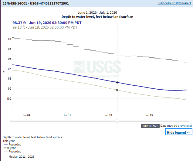
Groundwater also plays an important role. Much of the Spokane River is connected to the Spokane Valley-Rathdrum Prairie Aquifer, the underground water supply that provides drinking water for much of our region. During the summer, groundwater feeds water back into the river, helping keep it flowing when there is no more snowmelt and little precipitation. At the USGS monitoring well near Liberty Lake, groundwater levels are currently about one foot higher than they were at this time last year. However, they are still about three feet below the long term median. Interestingly, groundwater levels at this well in late June 2021 were very similar to where they are today, even though the river did not dry that year.
Looking at all of these indicators together, there is no simple answer. Some conditions, including snowpack timing, reservoir storage, and recent river flows, look very similar to last year. Other conditions, including soil moisture, precipitation, and groundwater levels, are more favorable than they were entering the summer of 2025. At the same time, years like 2021 and 2015 remind us that low water supply by itself does not necessarily mean the river will dry up.
So, could we see another dry river this summer? It is possible. But based on what we know today, it is still too early to say. This data gives us a good snapshot of current conditions, but they do not tell us exactly what caused the river to lose surface flow last year. Until we better understand that process, there is no single indicator, or even a combination of indicators, that can reliably predict whether it will happen again. We will continue watching conditions closely throughout the summer and share updates as the season unfolds.