This past summer, we saw something in the Spokane River that none of us had ever seen before: a stretch of river almost a mile and a half long completely dry. We’ve seen very low flows and dry side channels, but never anything this extreme. Community members who have lived and recreated on this stretch for decades reported this was beyond anything they had ever experienced.
THE MOMENT WE KNEW SOMETHING WAS WRONG
It started with a call. On Thursday, August 21, a local resident called to report something we never wanted to hear: “The river is dry here.” Jule was away on vacation, and the rest of us were wrapping up our workday. So I pulled up the data for our real-time temperature logger (which also measures water depth) in the river just upstream, which did not appear any different and still had a decent amount of water. Katie even offered to extend her drive home to take a look, but I waved it off. The logger looked normal, and honestly, a dry river just didn’t seem possible.
Friday rolled around, and I was on the water in a different part of the watershed, and more reports started rolling in. A guide on the water with me that day said he thought it could have been dry as early as August 19. The news was alarming, but I needed to see it for myself.
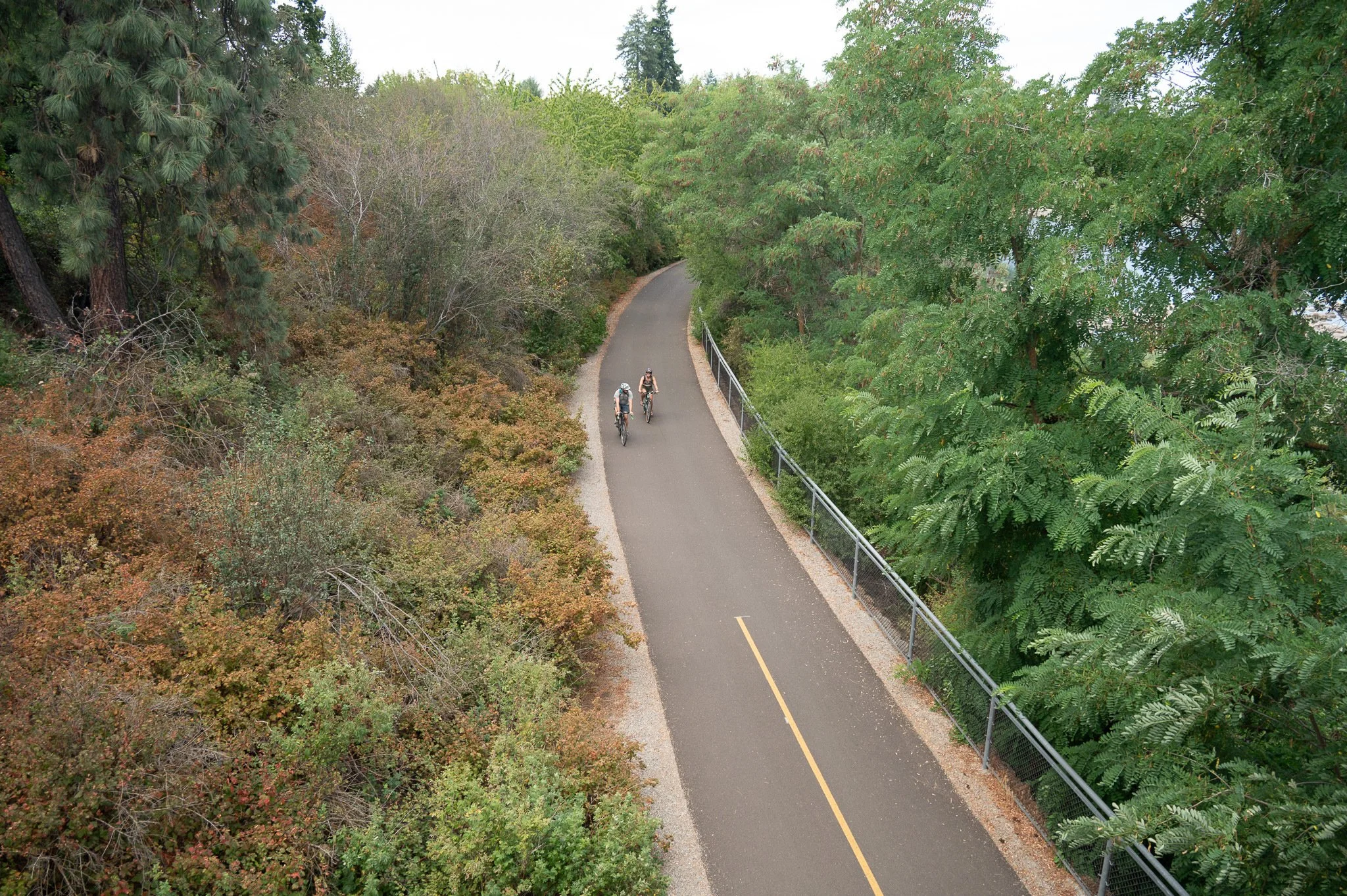
Biking along the Centennial Trail.
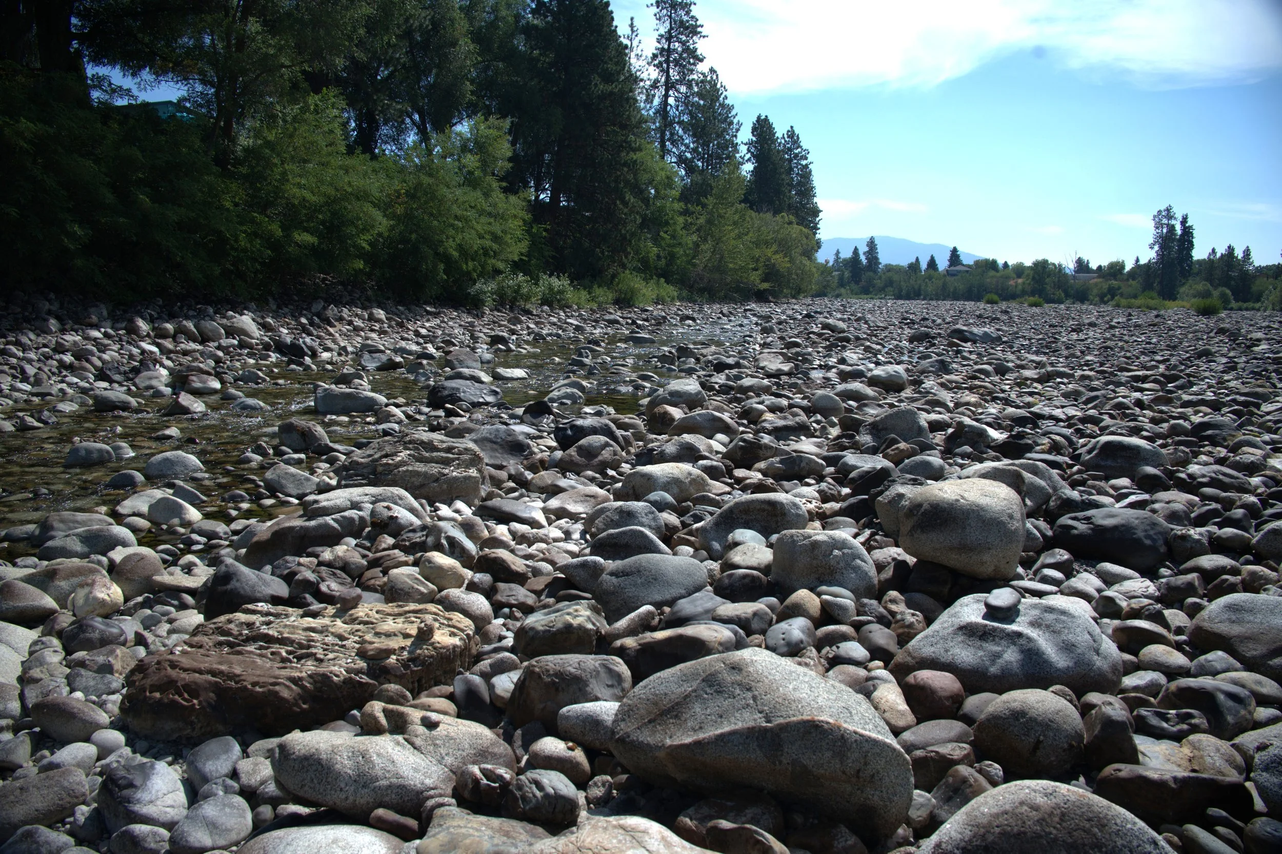
On Saturday, August 23, I grabbed my bike and one of our new board members, and we headed out to document the river firsthand. We parked at Barker Road and set off downriver on the Centennial Trail. At the trailhead, the river was low, but still there. Shortly downstream, the river began to break apart into pools. And then it was gone: the riverbed stretched completely dry for at least a mile, with only small, isolated pools left. The stretch reeked of death—the smell of the exposed fish and aquatic plant life rotting.
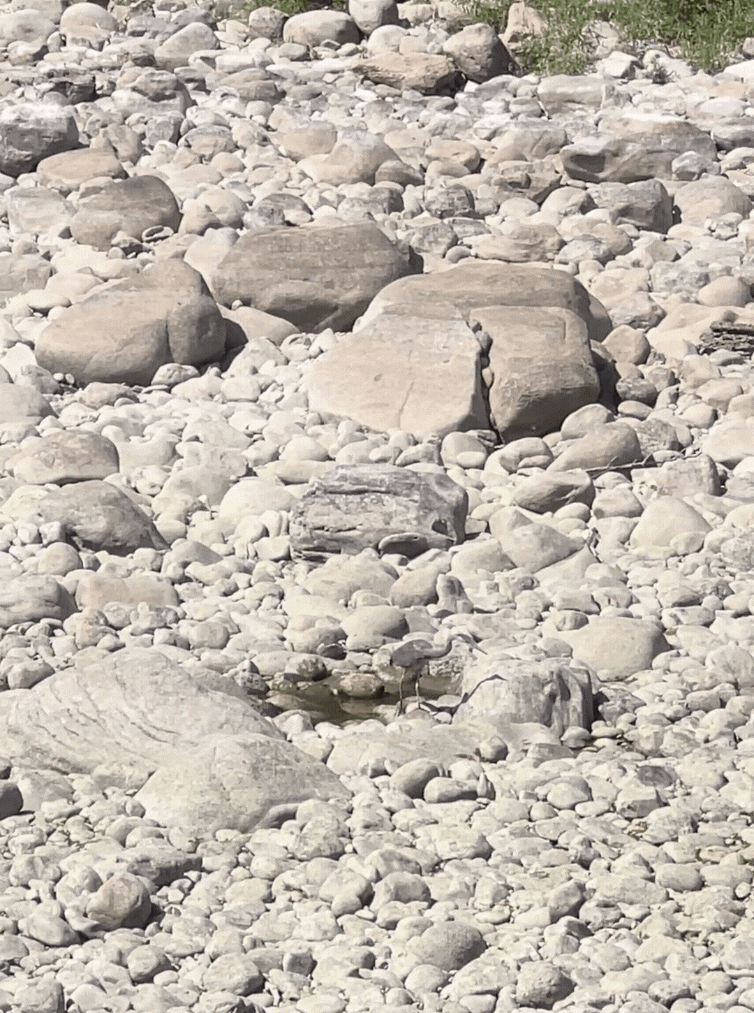
Heron fishing in a small pond left in the dry reach.
In one of those pools, a great blue heron patiently feasted on bass and crayfish trapped by the shrinking water. It was a stark illustration of what was happening to all the river’s residents. It was beautiful, haunting, and heartbreaking all at once. We took photos and videos, recorded notes on the locations where we saw water, and reported our findings to the Department of Ecology the next day.
On Monday, once Jule returned stateside and was back in the office, we decided to alert the broader public about what we were witnessing. Within hours, our press release and social media updates sparked attention from local media, and in the following week, 10 different news stories were published to help the community understand the severity of the low flows. (linked below)
TURNING SHOCK INTO STEWARDSHIP
Raising awareness was only the beginning. Alongside our outreach, we launched petitions to Spokane County, the City of Spokane, Liberty Lake, and Spokane Valley, urging meaningful water conservation action. Community response was incredible—over 1,300 signatures and endorsements from seven local organizations.
It's important to note why our immediate call to decision-makers was for meaningful water conservation measures. The Spokane River is hydrologically connected to the Spokane Valley-Rathdrum Prairie (SVRP) Aquifer. That means as the river flows across the surface, it is exchanging water back and forth with the underground aquifer. When water is drawn from the SVRP aquifer, the amount of water flowing in the Spokane River decreases. The more water we take from the aquifer, the more likely the recreation and ecology of the river will be threatened. Therefore, the need to address water conservation is vital for the future of our river, and all that it supports.
With record-high water use, years of intensifying heat and drought, and little change in local habits, this year’s dewatering wasn’t entirely unexpected — though it came sooner than many of us feared. We draw a tremendous amount of water from the aquifer. Average daily domestic water use per person in Spokane County in 2024 was 274.3 gallons per day, which was almost three times the national average of 82 gallons per capita per day (GPCD). Despite the watering ordinance passed in 2021, in 2024 the City of Spokane reported usage rates at 199 GPCD on average, down just 1 GPCD from when the ordinance was established. Conservation is something everyone can act on quickly, and it can make a tangible, lasting difference in buffering the river against future extreme events. And we still have a long way to go.
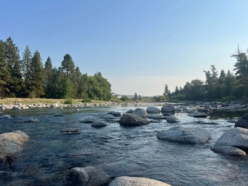
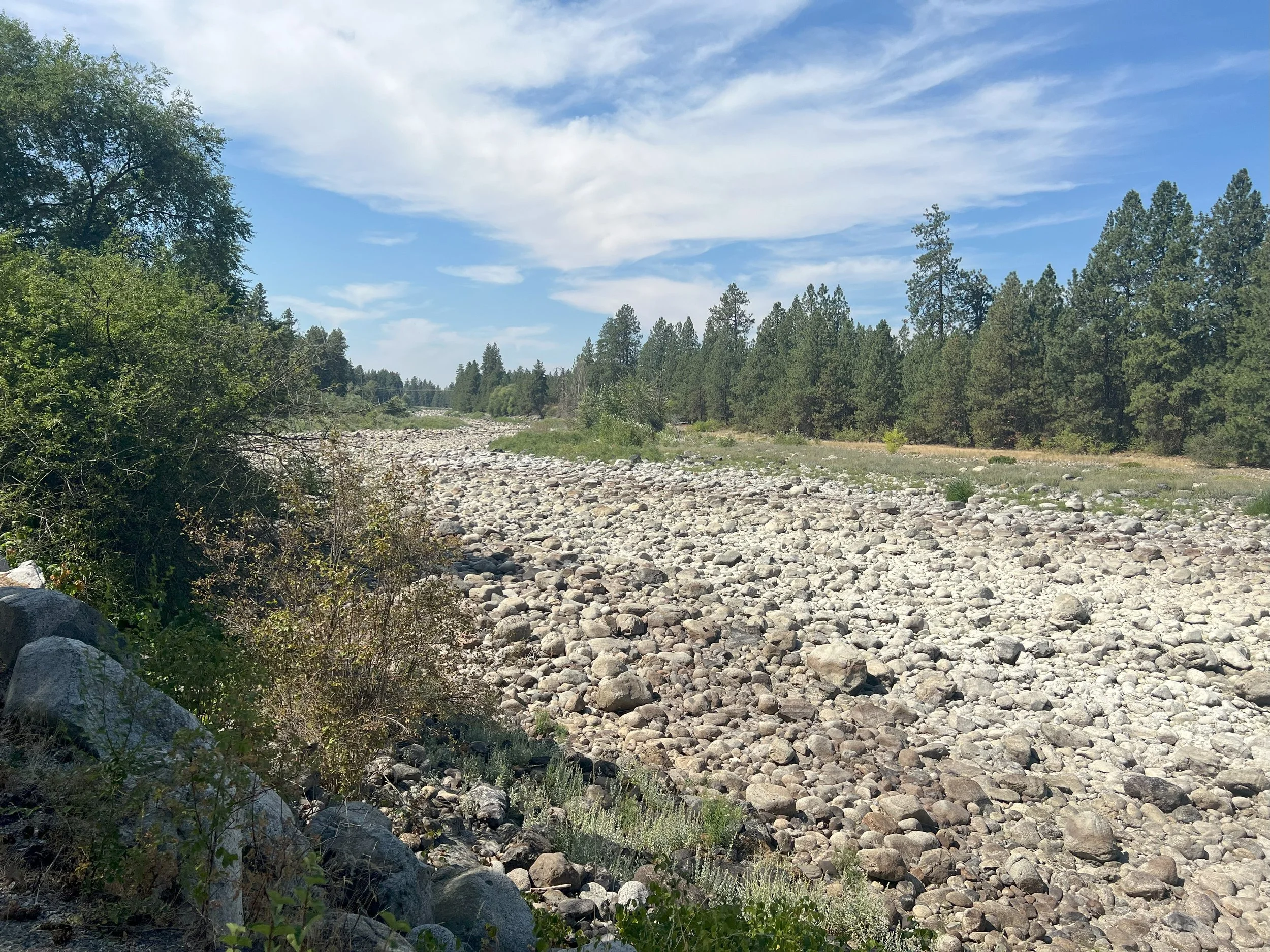
September 3, 2025, after flows had returned to the reach below Barker Road.
The river remained dry for about two weeks, with flows finally returning on September 2 around 5pm, about 8 hours after the increased flows from Post Falls Dam were released.
UNRAVELLING THE WHY
We still don’t have all the answers as to why the river went dry this year but we are fairly certain it has something to do with the connection between the river and the aquifer. We’re continuing to consult expert hydrogeologists to understand the data and why this happened. Some point to climate change and drought. Others suggest localized pumping or changes in sediment transports may have impacted the seepage rates in the river. Data from our temperature loggers, USGS flow gauges, and historical records are helping us put together the puzzle of this summer’s dry river, but we’re still missing some of the pieces.
A question we’ve heard often from the public is whether Post Falls Dam was responsible for the dry river (or, put another way, whether lowering the flows to 500 cfs caused it). And we’re pretty confident it isn’t. To explore this theory, we’ve looked at historical photos of the river during previous low-flow periods alongside dam flow records and gauge data in this reach. While we don’t have photos for every year and condition, the daily flow records at Post Falls date back to 1913.


Required flows at Post Falls have changed overtime as legal limits in Avista’s license have changed. The current license was established in 2009 through an extensive relicensing process. Prior to 2009, the dam could reduce flows as low as 250 cfs, but under its updated license it is now required to maintain higher flows, in a new attempt to balance recreation in the lake with ecological needs of the river. From Avista’s 2009 FERC license:
“To enhance aquatic habitat for the wild rainbow trout population downstream of Post Falls dam, the license requires Avista to maintain a minimum discharge of 600 cfs from the Post Falls dam from June 7 until the Tuesday following Labor Day each year, and reduce the minimum discharge to 500 cfs if the lake level falls below 2,127.75 feet during the summer full-pool period. The contingency for a 500-cfs minimum flow release will help ensure that sufficient water is stored in Coeur d’Alene Lake to maintain lake elevations for summer recreation, and provide for protection of aquatic habitat for rainbow trout in the Spokane River during low-water years.”
This year, the dam reduced flows to 500 cfs on August 6. But even with an early reduction, it is pretty clear that while the dam influences flows, that alone alone doesn’t explain why the river disappeared this year. However, we did see flows return quickly once outflows were increased this summer, showing that adjusting dam operations can still be a useful preventative tool if needed. Seeing the patterns—and the differences—helps us narrow in on other factors and guide our next steps.
Looking ahead, we will continue to analyze data, collect more data, and work with the community to press for solutions. Because the Spokane River isn’t just water flowing through a valley. It’s life, community, and history. And this summer reminded us, in the clearest way possible, that even a river we take for granted can vanish before our eyes.
So next time you walk along its banks or watch the water flow past, remember: the river’s presence isn’t guaranteed. And protecting it is up to all of us. If you see something unusual or potentially harmful on the river, let us know and join us in the effort for clean, abundant water.
Media Coverage
Spokane River reaches potential water record lows after 'perfect storm' of conditions | The Spokesman-Review, August 26, 2025
BONUS EPISODE: Stretch of Spokane River Goes Completely Dry | Cascades of History, August 27, 2025
Spokane River water levels reach possible new low | The Seattle Times, August 29, 2025
Spokane River in crisis as wildlife habitats dry up | Local News | kxly.com, September 1, 2025
A river in crisis | Video | kxly.com, September 2, 2025
A portion of the Spokane River ran dry last week. Can we do more to conserve water? | The Inlander, September 4, 2025
OUR GEM: Why the Spokane ran low and what it means for the future | Coeur d'Alene Press, September 20, 2025
Low Spokane River levels raise concern among experts | News | gonzagabulletin.com, October 2, 2025