
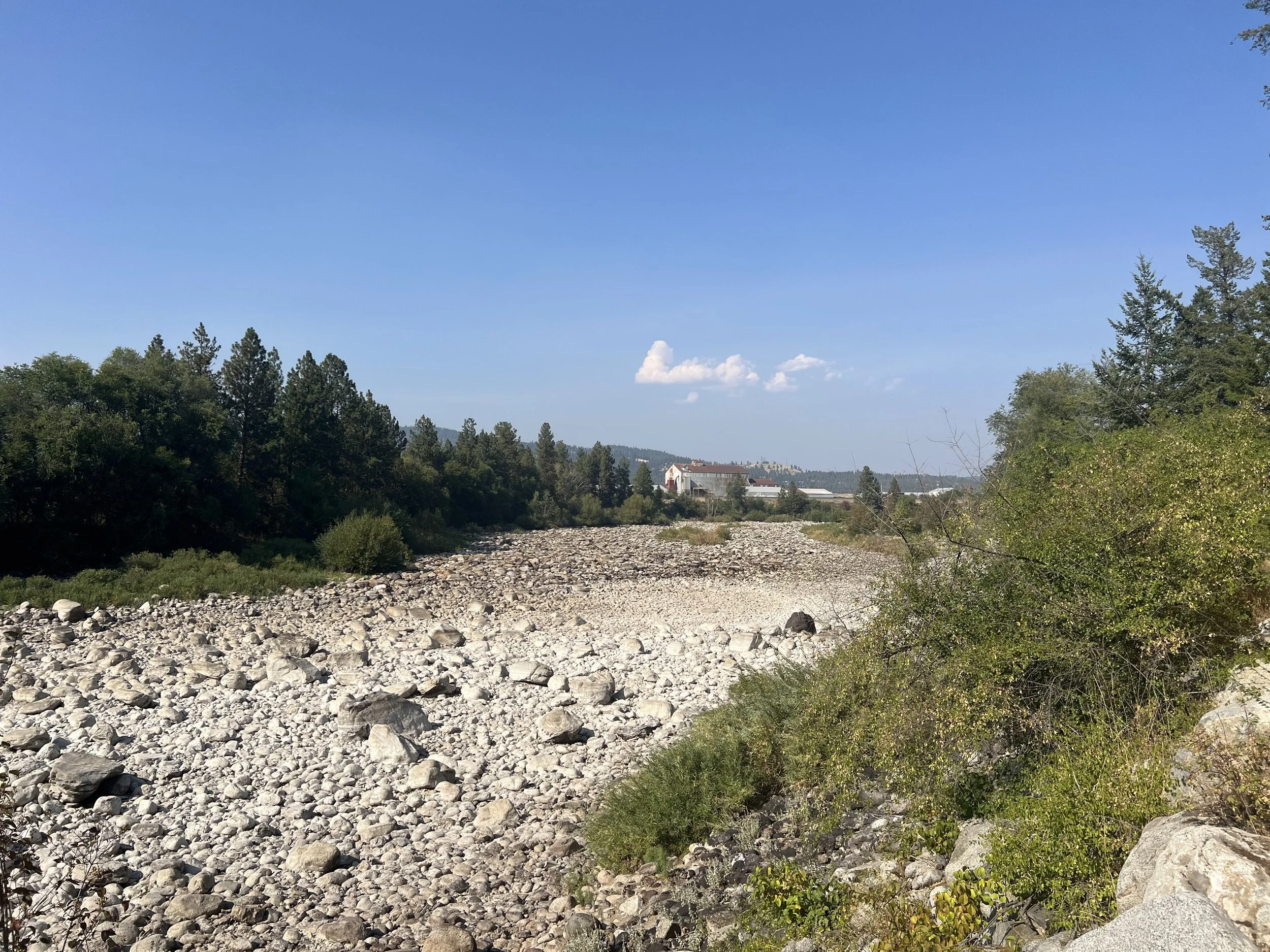
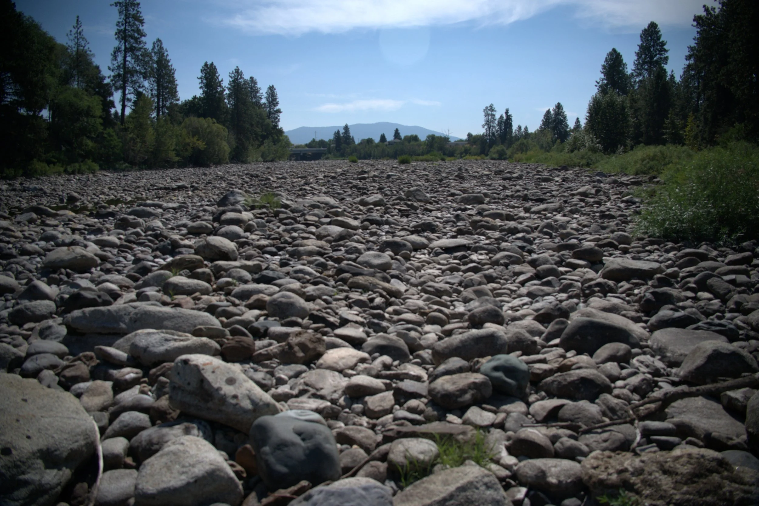
The Spokane River went completely dry in summer of 2025 for the first time on record.
The Spokane River drying up for 1.5 miles in the summer of 2025 was a seminal event in our regions history. This had never happened before. The bare rocks and dead crayfish that littered the once flowing river told us something we had been suspecting all along-something was wrong in our river. But to answer why the river went dry is proving more elusive as we enter the next summer of low rainfall that followed historically low snowpacks which usually feed our rivers. Luckily for us, many people love the Spokane River and want to help and a unique partnership with Spokane Community College is leading the way to understanding the system.
The Facts:
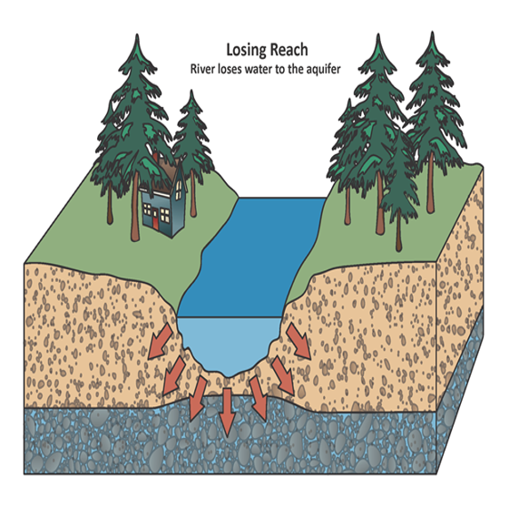
In losing reaches, such as the one that went dry on the Spokane River, the river seeps into the ground as well as flowing dowstream.
The Spokane River and Spokane Valley-Rathdrum Prairie aquifer are interconnected. The Spokane River from Post Falls to Flora Road loses water to the aquifer. This “Losing Reach” sustains aquifer levels through seepage through the river bed. But until recently flows had always been sufficient to provide surface water as far as Sullivan Road, where the aquifer flows back into the river, providing the majority of cold clear water downstream through the Spokane Valley and City of Spokane.
In 2009, Avista relicensed their dams, increasing the minimum spill at Post Falls Dam to 500 Cubic Feet per Second (CFS) from 300 CFS. The intention was to keep water in the river during the driest years. This means that despite the amount of water flowing into Lake Coeur d’Alene, at least 500 CFS will be flowing into the river. In many cases, less water flowing into Lake Coeur d’Alene than is flowing out of it causes the lake to drop, impacting recreation and other uses.
A Change in River Flows:
No river gage exists between Post Falls and the gaining reach. This means that over time, no one knew if the river was dropping despite constant inflows from Lake Coeur d’Alene. A number of United States Geologic Survey river gages had been placed in this section, but none had been recording data for years. Then suddenly, in August of 2025 the river dried up.
The Call:
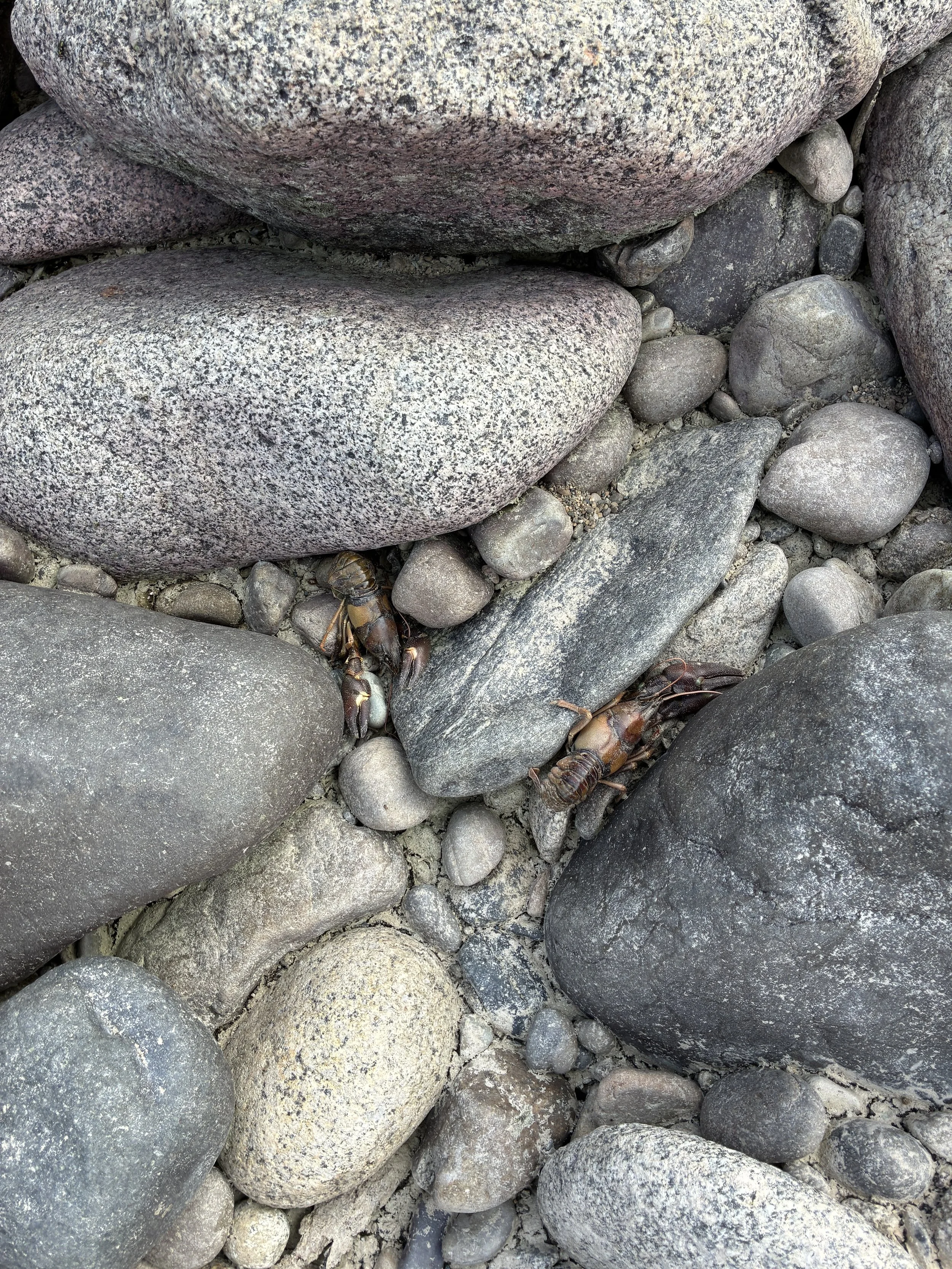
Thousands of dead crayfish littered the dry river bed.
We received multiple reports of a dry river on August 19th. The River drying up seemed impossible, so we asked the reporters to send photos. Sure enough, the river was so dry that in places you could walk across it without getting a foot wet. We went out to see for ourselves. What we saw disturbed us. Thousands of dead crayfish and bass, not to mention the macroinvertebrates that the fish depend on for food. The stench was overwhelming. We immediately reported this issue to local officials, media, as well as our own social media. Despite widespread coverage, no one had an answer. The public suggested looking at Avista, or data centers, or rampant development, or over watering lawns. No answer satisfied us. Something had changed dramatically in the system, and recently. 2021 photos showed water flowing in this stretch of river despite low flows.
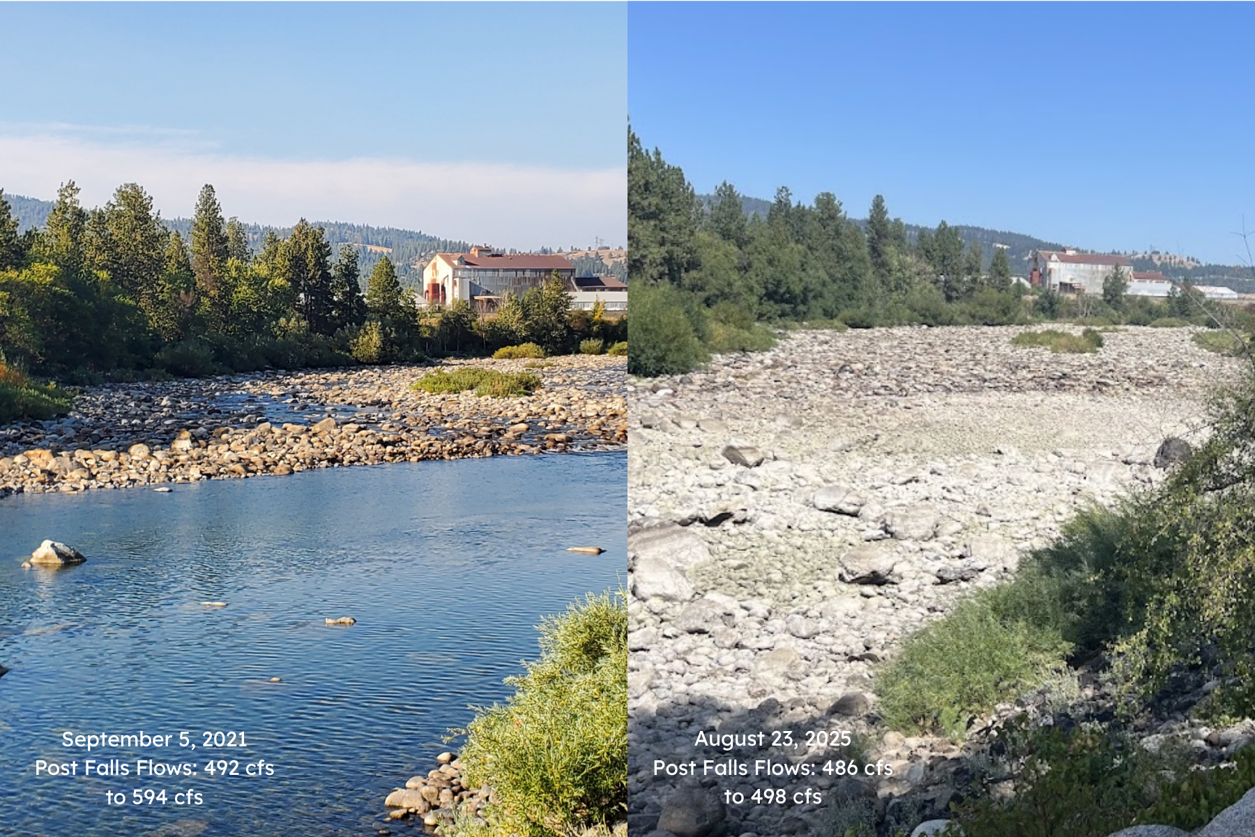
Flows existed in the Spokane River in 2021 despite almost identical environmental conditions to 2025.
The Partnership:
After months of calls with local hydrologists, we knew we needed to understand where in the river the water was leaving the system. We ended up chatting with my friend David Stasney of Spokane Community Colleges. His water resource program trains students to measure water flow to enter jobs with the USGS, Army Corps of Engineers, and other water related fields. They have a stable of high tech equipment and trained professors that may be able to help. After some discussions, I realized that his program may be able to unlock where the water was going. It involved what was called a “Seepage Run”.
The Science:
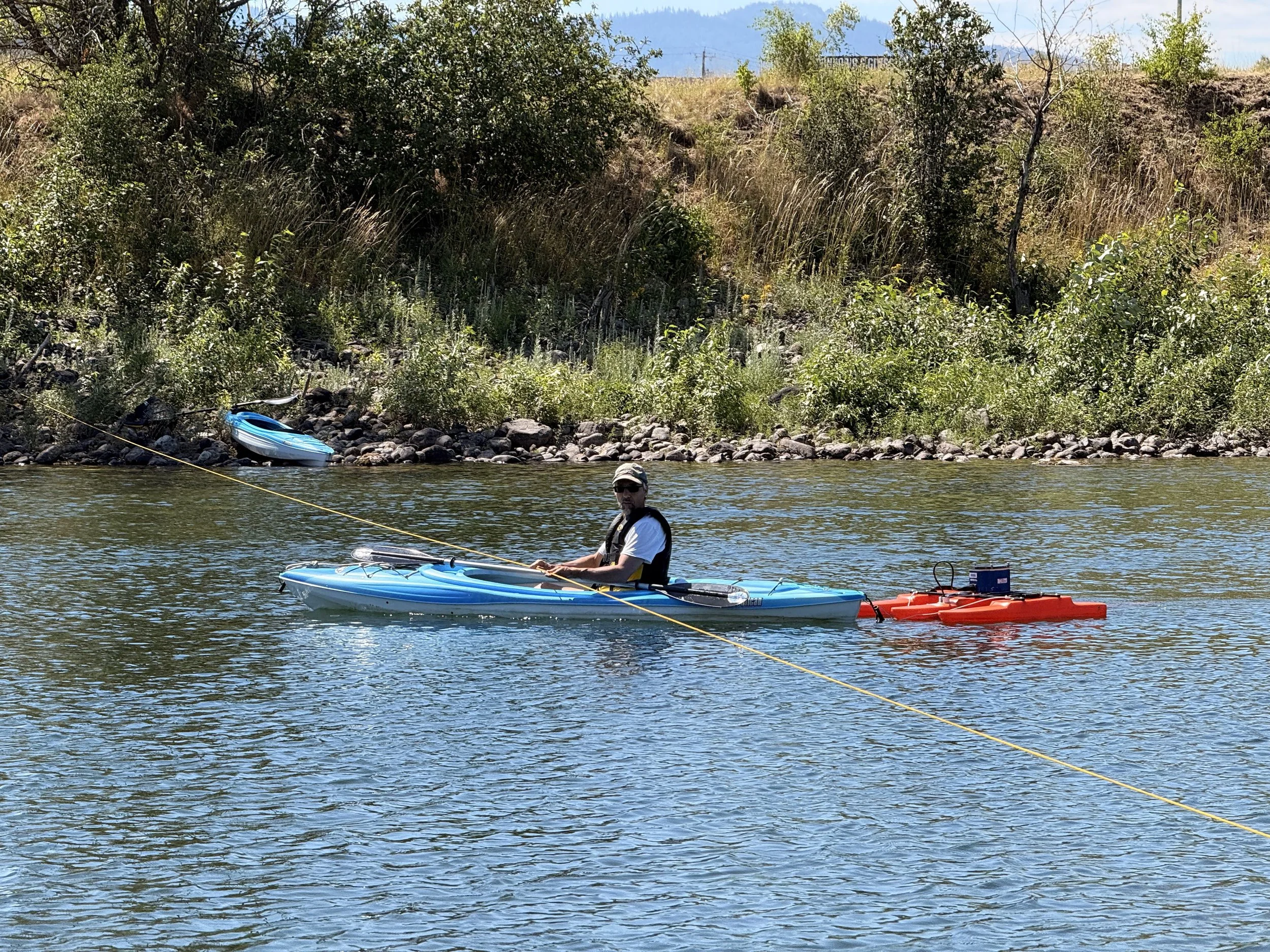
Spokane Community College is using high tech flow monitoring equipment to measure flow at key locations on the Spokane River.
The methods are simple. Measure flow at select locations along the river to determine what stretches are losing the most water. Scientists will use advanced doplar radar that measures the velocity of particles and the depth of the river. From this they will calculate flow in CFS. Getting the measurements and calculations correct is the hard part, and we are lucky to have a team of trained scientists from SCC helping us out.
However, this hadn’t been done for years. The last Seepage Run in 2005 showed only 332 CFS leaving the system. That is not enough to dry up the river. At least 500 CFS was leaving the system in 2025 to dry up the river. If they can isolate areas of increased seepage, that could narrow our search geographically for the cause of the dry river.
More Than Just Flow:
This study conducted by SCC complements other work in the basin. Other organizations are looking at water use and aquifer height. These may also impact river flow. Although this section of river is a losing reach-a one way street for water-the distance it has to flow vertically can change it’s rate of seepage according to Darcy’s Law. In addition, increased water use by domestic suppliers may be pulling water from just under the river without know it.
Much remains to me seen about where the river is going. Stay tuned for the complete report in Fall of 2026. Until then get out and enjoy the river. Fish, float, or simply walk along it’s banks.