
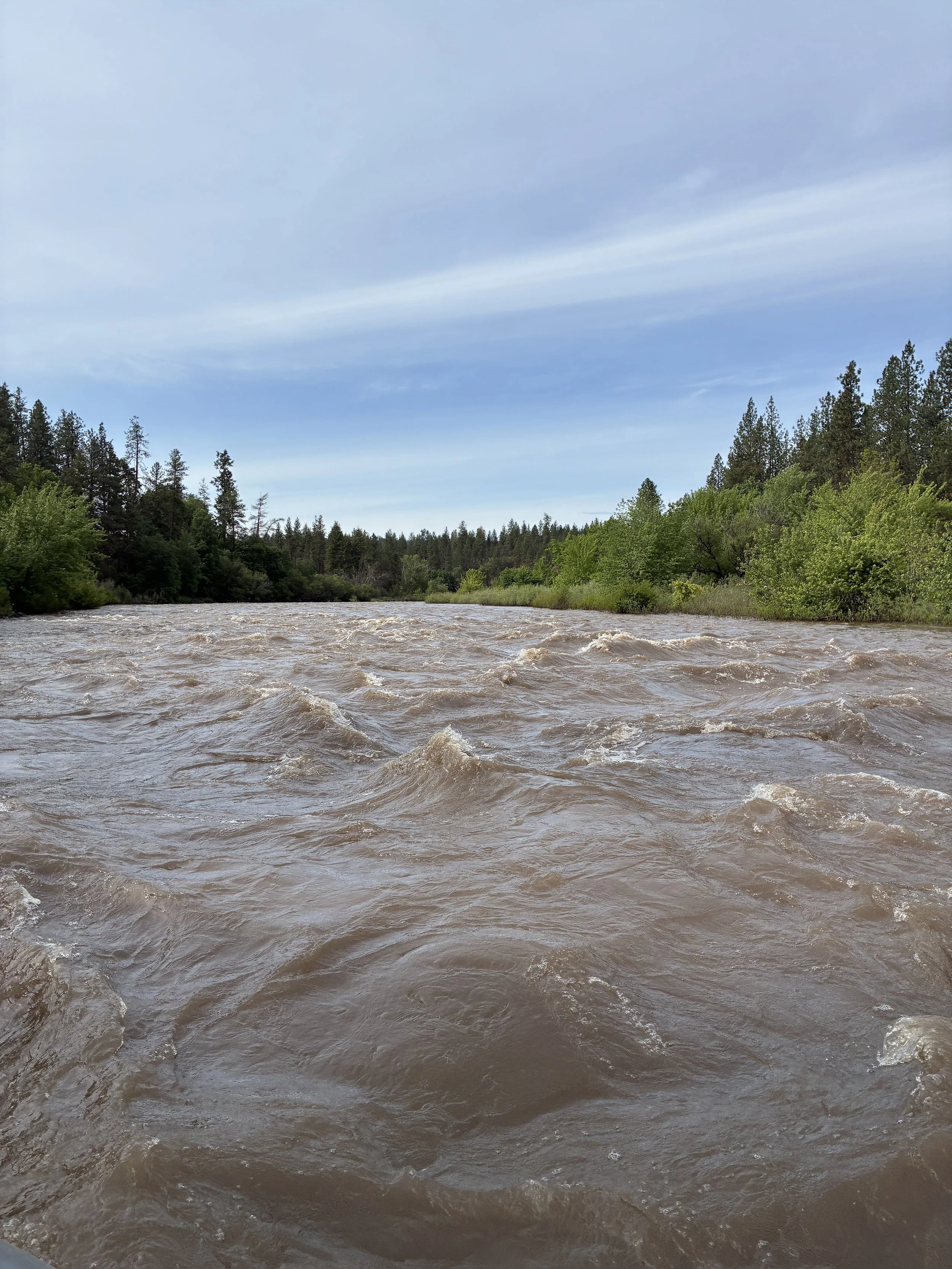
Hangman Creek is known for it’s muddy waters that frequently follow rain on snow events or thunderstorms-an unfortunate result of losing the riparian vegetation and floodplains in the watershed. However, the muddy waters that followed late May’s thunderstorms in 2026 was worse than we’ve ever seen.
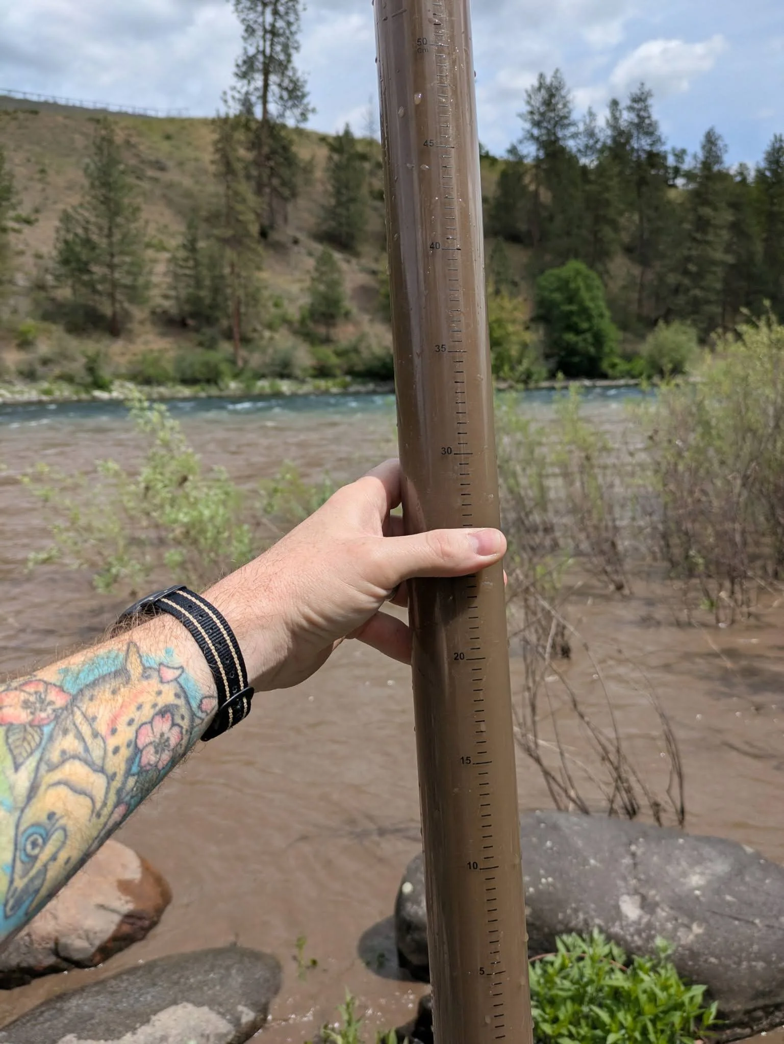
Community scientists collect data with turbidity tubes. This is the sample from Sunday May 31st 2026.
Our community science volunteers have been collecting high quality data for over 6 years to show the impact of the muddy waters of Hangman Creek on the Spokane River. These samples and data show that during the six month sampling period Hangman Creek violates state water quality standards about 80% of the time-while the Spokane River does so about 20% of the time. The standard is 5 NTU (Nepholometric Turbidity Units-which equates to about 60 cm of water clarity)-the samples taken this weekend ranged from 3,800 to 6,000 NTU or 780 to 1,200 times the state standard! This is due the enormous amount of dirt that washed into our stream this past week.
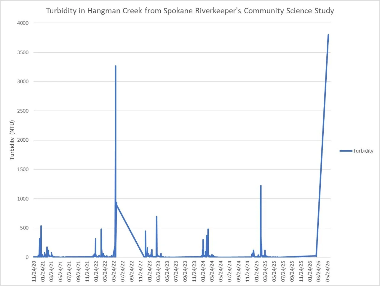
A quick look at the last 1,200 data points taken over 6 years shows how bad water quality was during the late May sampling event.
These standards protect our native redband trout and the reintroduced salmon in our watershed. High amounts of sediment is akin to impacts of wildfire smoke on human-with the addition that fish are visual hunters that need clear water to feed.
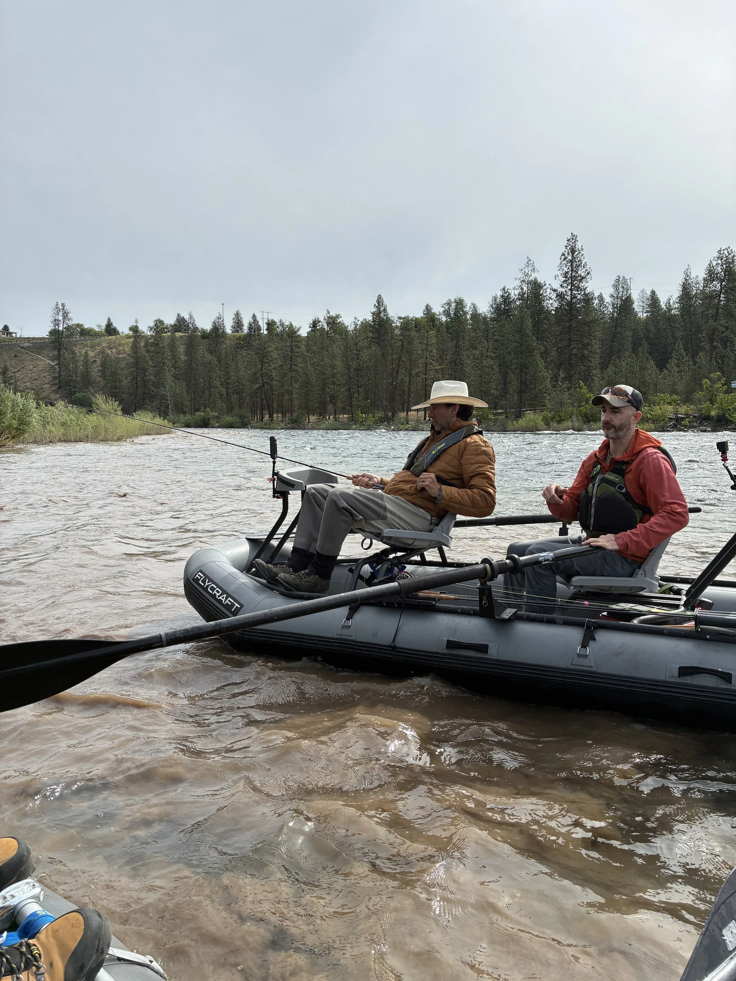
Fishing guides typically pull up their lines during these muddy water events at the mouth of Hangman Creek.
But the impacts are well beyond impacts to fish. This dirt carries fertilizer that causes myriad water quality issues in Long Lake Reservoir low dissolved oxygen for one. Local fishing guides can’t fish this stretch of river when muddy waters enter our creek-an economic impact that often goes uncounted. And it’s just plain ugly.
Water quality suffers in Hangman Creek for one because of land use practices. Little riparian (streamside) vegetation remains, having been replaced by agricultural fields or roads- causing banks to erode and water to stream off of the land unfiltered. This, combined with a loss of floodplain, straightening the creek and tributaries, and other land use practices have cause the pollution we see today. We’ve previously highlighted on our blog the complicated discussion continue to have in the basin with land owners-especially agriculture producers-all of who are responsible for clean water.
When an intense thunderstorm hits-water runs off the land quickly, and unfiltered, bringing high flows and muddy waters, that causes even more erosion. We’re not sure how this storm event differed to cause this enormous pollution, but we do know that continued restoration of our creeks and tributaries can reduce the impacts of events like these.
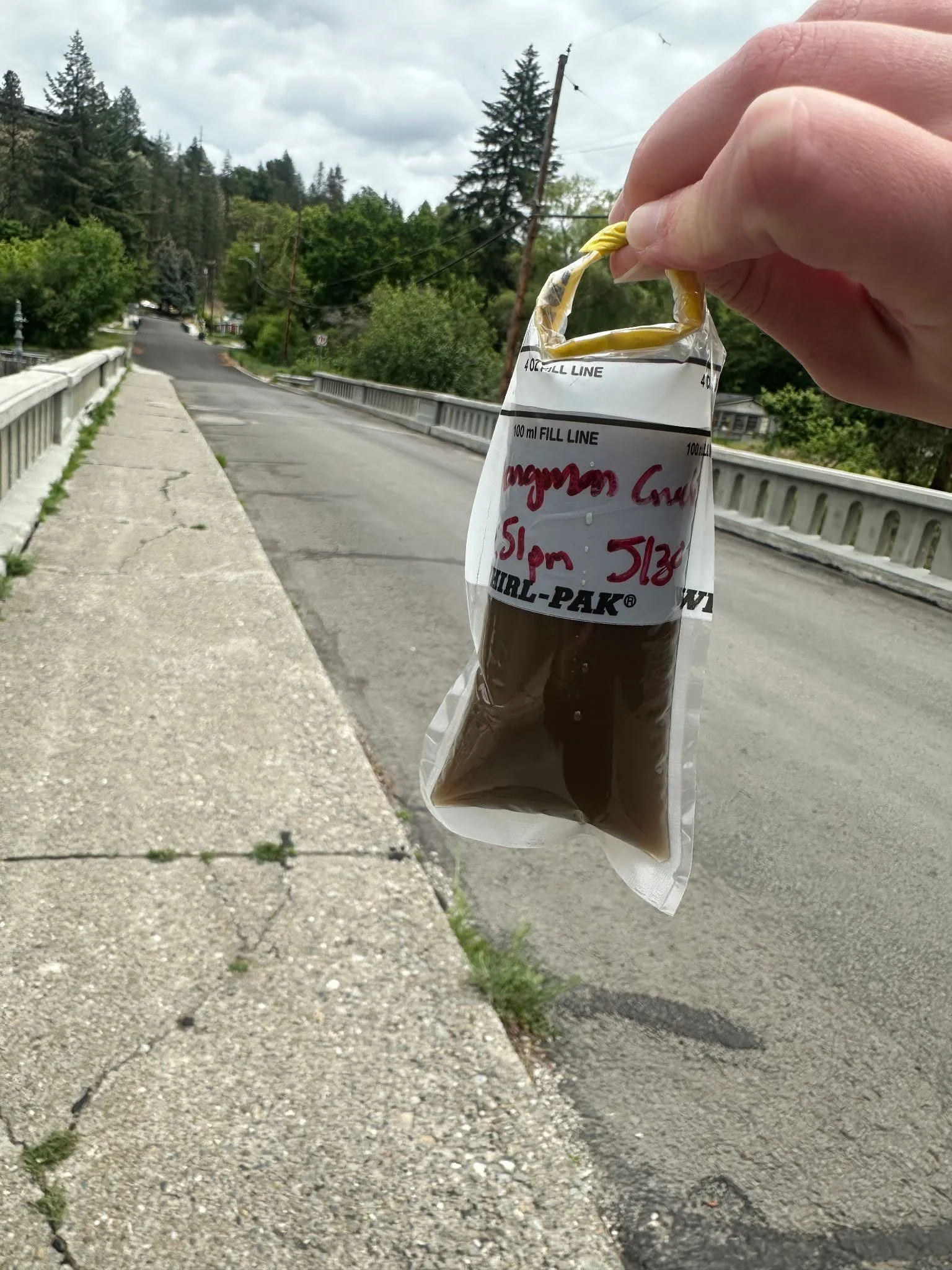
Samples like this one collected May 30th are run on a turbidimeter to measure turbidity.